The edited volume Frontier Tibet: Patterns of Change in the Sino-Tibetan Borderlands (2019) is the last publication in the framework of this ERC project, and it includes a series of maps that we provide here in higher resolution than what was possible in the print or PDf (open-access) versions of the book.
The maps are made available here under the same Creative Common license (BY-ND-NC) as the book. Please attribute and provide full references. (These are large files, allow some time for them to load after you click on the image.)
List of maps (and chapters of the book in which they figure):
Map 1: General map of the study area (Rémi Chaix)
Chap. 1 Frontier (of) Experience: Introduction and Prolegomenon (Stéphane Gros)
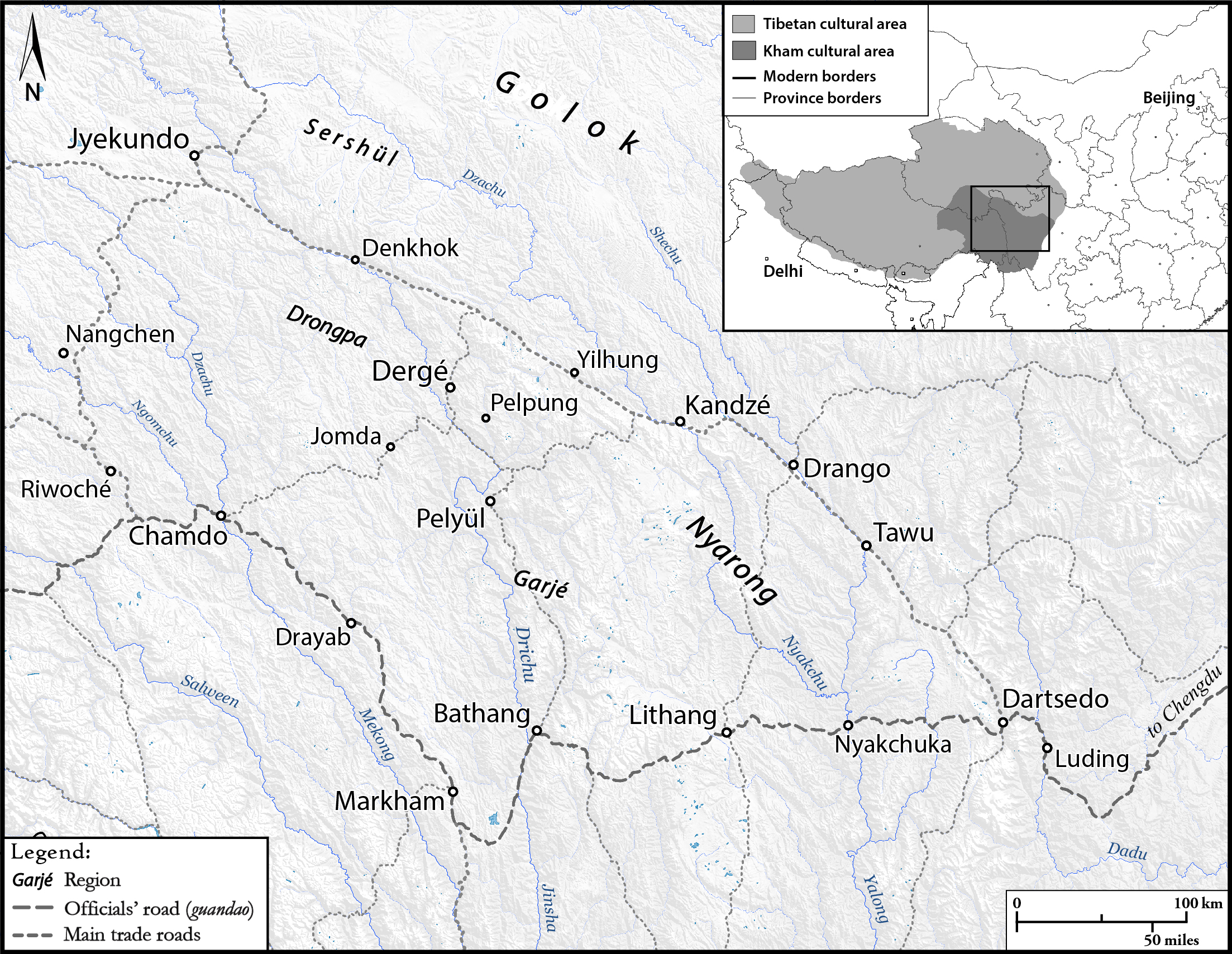
Map 1.1: Situating Kham (Rémi Chaix)
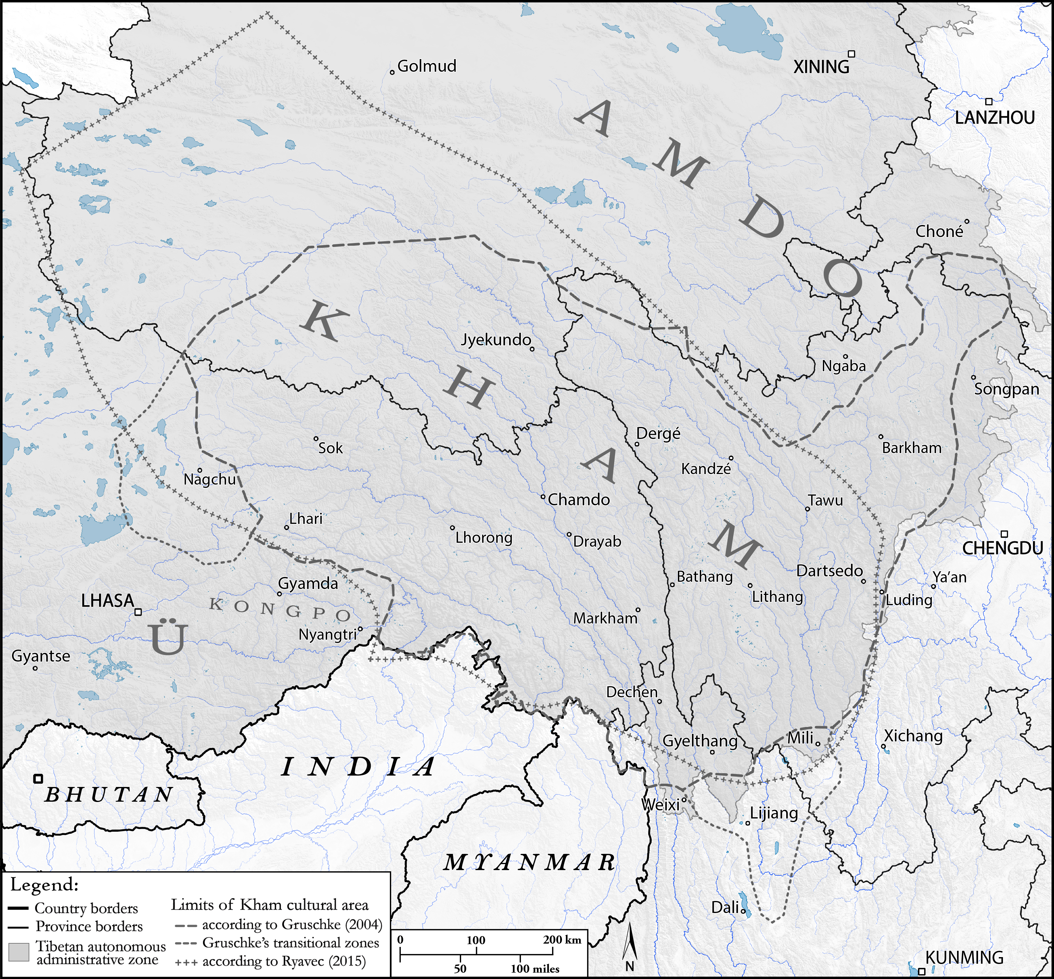
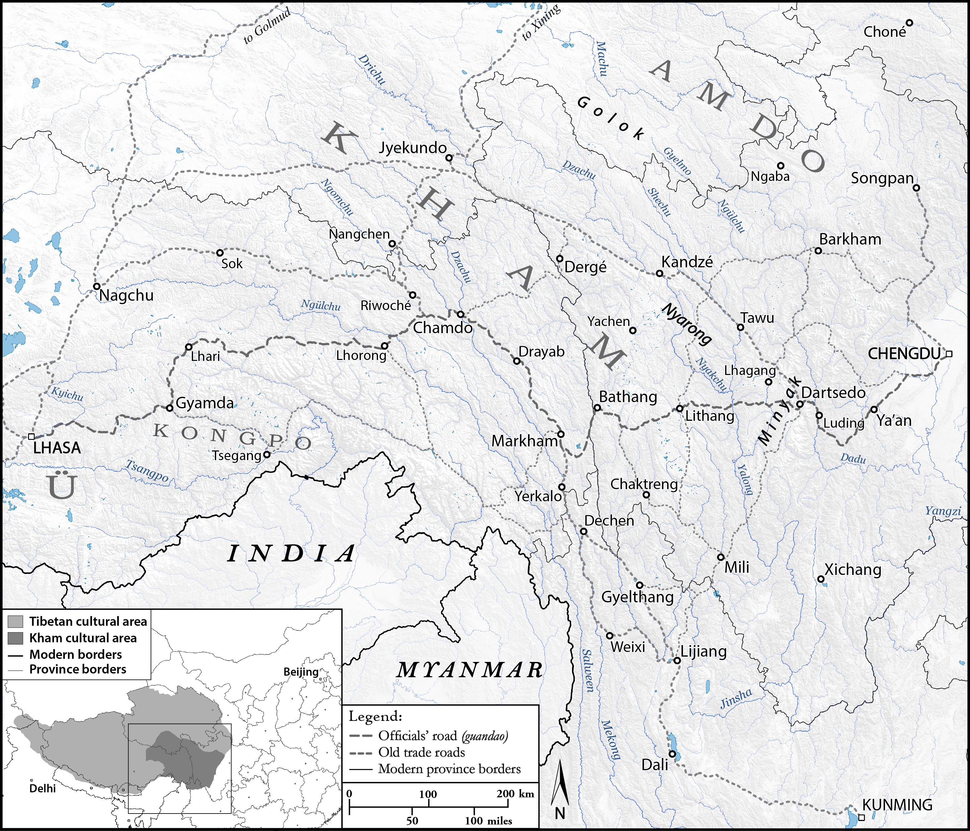
Map 1.2: ‘Inner Tibet’ and the limits of Central Tibet Government according to McMahon’s line (Simla Convention) (Rémi Chaix)

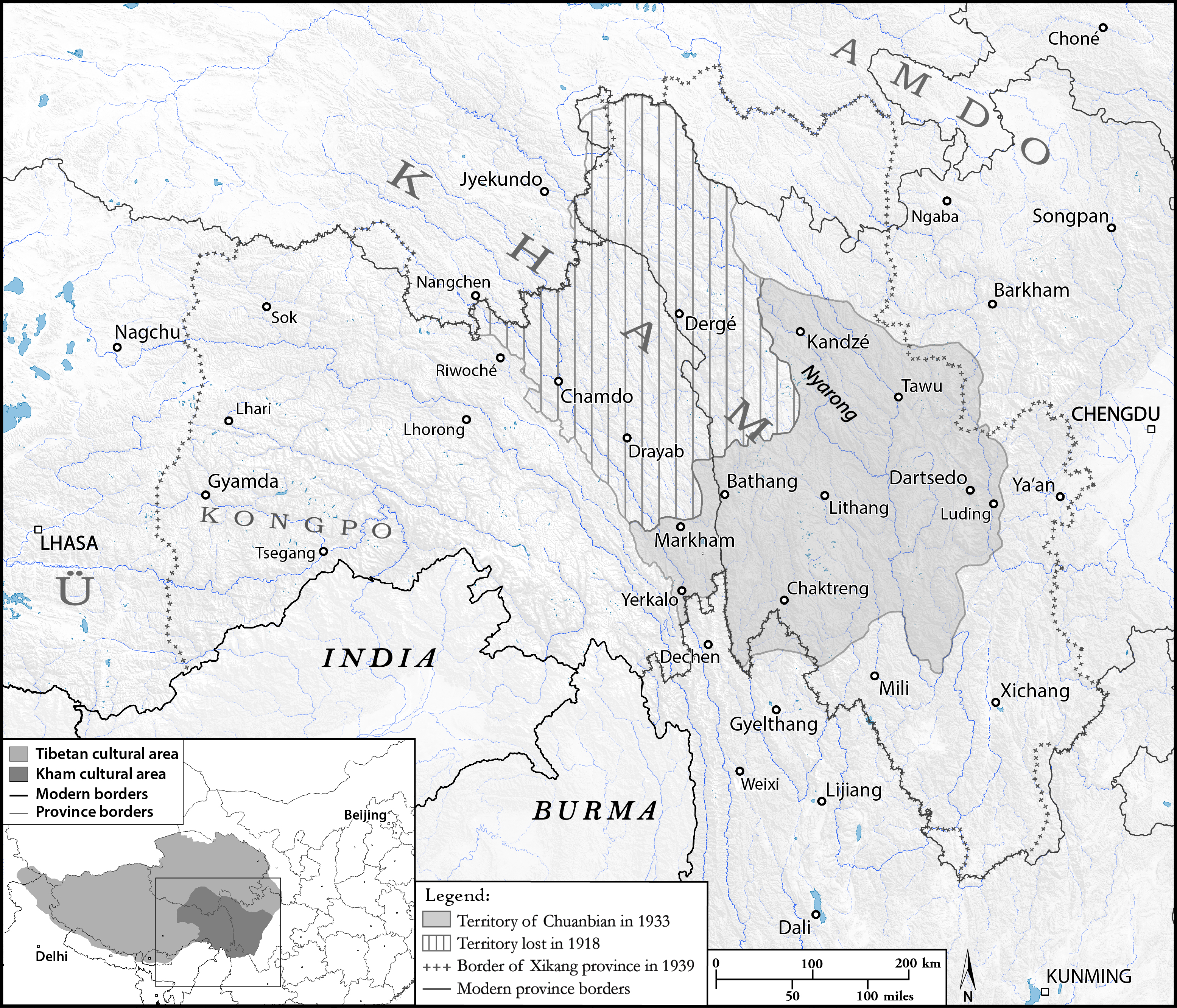
Map 1.3: The borders of Xikang province as defined in 1933 and 1939 (Rémi Chaix)
Map 1.4: The Great Shangri-La Eco-Tourism Zone (Rémi Chaix)

Chap. 3 Boundaries of the Borderlands: Mapping Gyelthang (Eric D. Mortensen)
Map. 3.1: Gyelthang (Xianggelila) and its surrondings (Rémi Chaix and Stéphane Gros)

Chap. 4 Trade, Territory, and Missionary Connections in the Sino-
Tibetan Borderlands (John Bray)
Map 4.1: The principal M.E.P. mission stations in the Sino-Tibetan borderlands, c. 1900 (Rémi Chaix and John Bray)

Chap. 5 Settling Authority Sichuanese Farmers in Early Twentieth-Century Eastern Tibet (Scott Relyea)
Map 5.1: Map showing 1727 Stele and the main trade road through Kham. Inset: Location of Kham within the Qing Empire (Rémi Chaix)

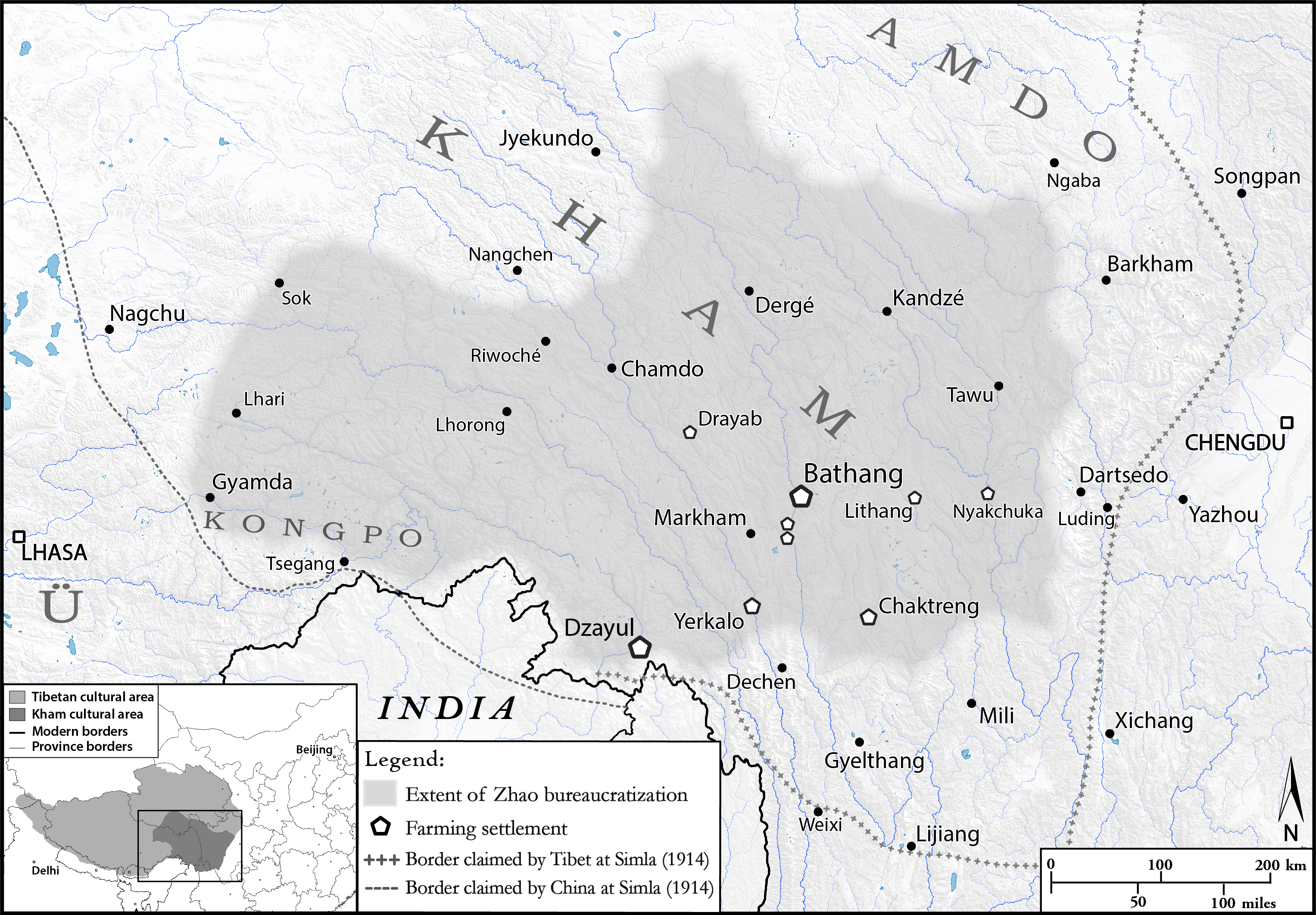
Map 5.2: Full extent of Zhao Erfeng’s bureaucratization and location of main farming settlements, with indication of Tibetan and Chinese claims at Simla (Rémi Chaix and Scott Relyea)
Chap. 6 Wheat Dreams Scientifijic Interventions at Chinese Model Farms in Kham, 1937-1949 (Mark E. Frank)
Map 6.1: Map of Xikang territory showing the locations of the Simaqiao and Taining experimental stations (Rémi Chaix and Mark Frank)

Chap. 10 The Dispute between Sichuan and Xikang over the Tibetan
Kingdom of Trokyap (1930s-1940s) (Fabienne Jagou)
Map 10.1: Localization of The Kingdom of Trokyap, c. 1940 (Rémi Chaix)

Chap. 11 The Rise of a Political Strongman in Dergé in the Early
Twentieth Century: The Story of Jagö Topden (Yudru Tsomu)
Map 11.1: Dergé at the time of Jagö Topden (Rémi Chaix)